Sunday, July 22, 2012

July 19, 2012 - Anchorage: Kincaid Park (YRE)


Getting ready to walk


On a gorgeous sunny morning  we took our second walk with the group from Walking Adventures International.  It was fun to show off one of our most beautiful parks to visitors.


This bunker is used as a waxing room during Nordic ski races
Kincaid Park is a 1,516.78-acre municipal park, but it wasn't always a park.  In 1959, the military base at Kincaid (then called Point Campbell) became host to the first operational Nike-Hercules Unit. The site housed one of the most advanced radar systems of the day, maintained 24 hours a day with 100 men on alert seven days a week. The missile battery was deactivated in 1979 and assigned to the jurisdiction of Elmendorf Air Force Base. The Air Force transferred the land to the Municipality of Anchorage through the Federal Land Surplus Act on November 25, 1980.  A number of massive concrete bunkers and missile silos can still be seen here and there throughout the park.

Today, Kincaid Park hosts many events each year, including international cross-country skiing competitions, Special Olympics, Tuesday Night Races, high school cross-country running and cross-country ski races, and the Ski For Women event. 

The Chalet
Noted for Nordic skiing trails (including 17k of lighted trails), other winter uses of the park include biathlon, snowshoeing, and sledding.  In snowless months the park is frequented by runners, bikers, hikers, archers, dog-trainers, motocross users, disc golfers, soccer teams, rollerskiers, orienteers and geocachers.  Little Campbell Lake offers ice-fishing in winter, boating and fishing in the summer.
The Kincaid Outdoor Center  (a/k/a "The Chalet") has a spectacular view of Denali, the Alaska Range and Cook Inlet, Fire Island, and jets landing at the airport.  It can be rented for weddings and other private events.
That's not snow on the trail - it's cottonwood detritus


The park is mostly forested, with birch, cottonwood, and spruce. Wildlife includes moose, lynx, bear, fox, eagles, porcupines, owls, and many others.

Pluto


Our walk started and ended at the Chalet.  Right in front of the Chalet is the" Pluto" station in the Anchorage Lightspeed Planet Walk, described in yesterday's post.

Memorial at the beginning of Margaux's Loop

We went with the "less fast" group and did the 5k walk.  We took time to notice plants and flowers and animal tracks and enjoyed our slower pace.  While our group did not encounter any wildlife during our walk, the "gazelles" ran into a couple of moose during their 10k walk.  Our walk followed the hilly trail known as Margaux's Loop, a cross-country ski trail in the winter.  The steeper sections of the trail had names like "Little Niagara" and "Roller Coaster."


It was early, so we didn't see many people on our walk.  We did encounter one mountain biker who said he hoped we were enjoying "the best park in Anchorage."


Birches


Walk Route:   B

Walk Documentation:   C

Maps are posted along the trail - not sure if they help
Comments: This walk is very difficult to follow if you are not familiar with Kincaid Park. It's not that easy, even if you have done it before. I would suggest revising the directions so that each maneuver is a separate numbered paragraph.  In general, it is easier to follow a series of short instructions, rather than one lengthy paragraph containing several instructions. Because there are very few landmarks and lots of crisscrossing trails, the directions need to be very precise.  It would also be helpful to indicate approximately when each kilometer has been completed.

July 18, 2012 - Anchorage: Coastal Trail (YRE)

We met up with a group from Walking Adventures International to do the Coastal Trail walk on a gorgeous sunny day. 

We started downtown at the Alaska Public Lands Information Center.  The route took us past the Alaska Center for the Performing Arts, Town Square Park, City Hall, the Wyland mural, the Anchorage Museum of History and Art, and the Federal Building. 

From this point, the route is not that interesting  for the next 2k as you head south toward the park strip and then continue down A Street past the Chester Creek Sports Complex to the Chester Creek Trail.

The Chester Creek Trail is a very pleasant paved trail that follows Chester Creek past Valley of the Moon Park to Westchester Lagoon.   Upon reaching Westchester Lagoon, the trail emerges from the trees and runs along the lagoon toward a playground, ending at the Tony Knowles Coastal Trail.

Sleeping Lady
The Coastal Trail is a busy paved trail used by walkers, runners, cyclists, rollerbladers and others.  It follows the Anchorage coastline from Kincaid Park to downtown, offering splendid views across Cook Inlet of  Mt. Susitna ( the "Sleeping Lady") and the Tordrillo Range behind it.    
 
An Alaska Railroad train passed close by during this portion of our walk.

Gardens at the Oscar Anderson House


At Elderberry Park, we passed the Oscar Anderson House Museum.  This house, built in 1915, was the first wood-frame house in Anchorage.

Some of the group from WAI
At the end of the Coastal Trail, the route continues down the hill to the Alaska Railroad Station, Ship Creek, and the Ulu Factory. An ulu is a type of knife traditionally used by Eskimo women.

A couple of suggestions:

1) A one half block detour from the Performing Arts Center takes you to the "Sun" at the beginning of the "Anchorage Lightspeed Planet Walk."  (http://anchorageplanetwalk.org/index.html).  This is a very cool exhibit. The Anchorage Light Speed Planet Walk is a scale model of our solar system. Taking the walk, you experience the relative size of the planets and their distance from the Sun. The scale was chosen so that a leisurely walking pace mimics the speed of light. On this scale, each step equals the distance light travels in one second (300,000 kilometers or 186,000 miles).  You will be able to see Mars in Elderberry Park and Jupiter on the Coastal Trail at Westchester Lagoon on the Coastal Trail Walk. If you do the Kincaid Park walk, you will see Pluto.  Mercury, Venus and Earth are not far from the Coastal Trail Walk route (and perhaps are included in the Route for the Anchorage Historical Walk). 

2) I would rather walk down G Street from downtown, passing the Fire Island Rustic Bakeshop.  The current routing down A Street exposes walkers to a lot of traffic and the occasional group of homeless individuals loitering along the way.  The G Street route could cut over to E Street at 15th and follow E Street to the Chester Creek Trail.

Walk Documentation: B-

Walk Route: B-

Thursday, July 19, 2012

July 16, 2012 - Asbury Park (YRE)


Asbury Park, New Jersey is one of the larger towns on the Jersey Shore. Bruce Springsteen got his start here. We started the walk in the business district and quickly found ourselves crossing a footbridge into the neighboring town of Ocean Grove ("God's Square Mile at the Jersey Shore").

Ocean Grove was established in 1869 by a group of Methodist clergymen who wished to develop a summer "camp meeting" site on the Jersey shore. (The camp meeting movement set up campsites for people who wished to camp out, listen to itinerant preachers, and pray together.) The land in Ocean Grove is still owned by the Ocean Grove Camp Meeting Association and is leased to homeowners and businesses.


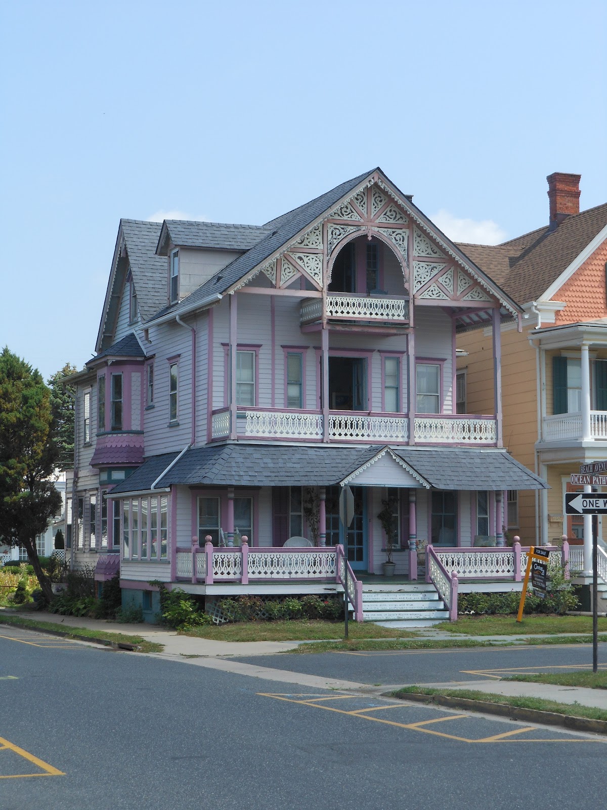
The first thing you notice is the abundance of Victorian houses.  In fact, Ocean Grove claims to have the greatest extent of Victorian and early 20th century architecture in the US.
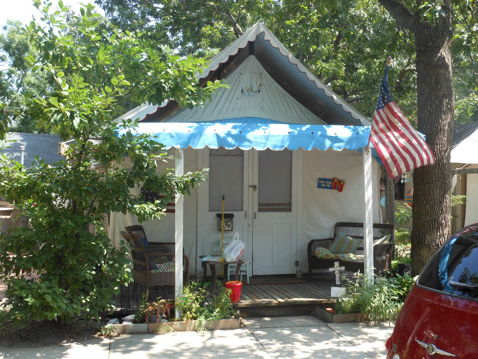
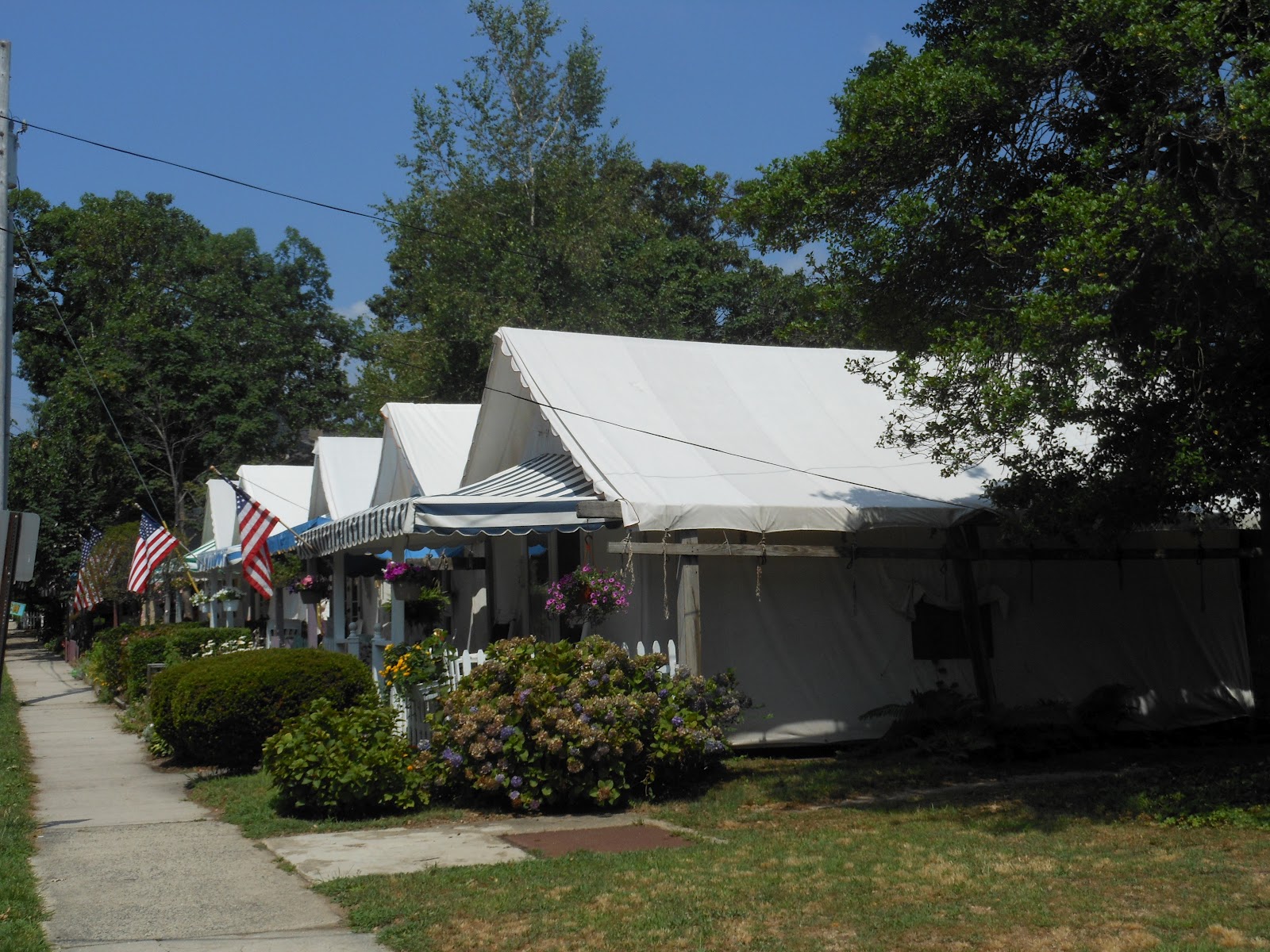


Tent House


As you get closer to the beach, you come upon a few blocks of tent housing. There are 114 tents in all, and they are occupied from May to September. We were there on a really hot day and the tent housing looked like it would have been unbearably hot. They adjoin sheds in the rear that contain kitchens and bathrooms. People were inside the tents and sitting in front of many of the tents (and baking in the midday sun). It looked like a hot, cramped way to spend your summer vacation, not to mention the lack of privacy.  And yet, there is said to be a ten-year waiting list to rent them.


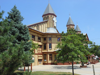
The Great Auditorium


 We next encountered two large wooden structures: the "Great Auditorium," built in 1894, and the Youth Temple. These structures are the hub of the community.


We proceeded down a couple of grassy blocks toward the beach. These blocks had a few flowers, but no trees and they were scorched by the sun. An interesting assortment of Victorians faced each other across this grassy strip. Some of them appeared to be historic; others appeared to be reproductions, a la Disney's planned community, Celebration, in Florida.

Upon reaching the boardwalk we found a large pavilion where "Pavilion Praise" worship services are held on Sunday mornings. (I did not learn until after the walk that the Boardwalk Pavilion was at the center of a huge controversy. In 2007 a same-sex couple filed a civil rights complaint against the Ocean Grove Camp Meeting Association claiming discrimination because their request to hold a civil union ceremony in the Boardwalk Pavilion was denied. The Camp Meeting Association filed a suit in Federal Court to enjoin the state's investigation, but that effort was not successful.  Ultimately, in 2012, a state administrative law judge issued a decision holding that the Camp Meeting Association had violated the New Jersey laws against discrimination.)

We turned and followed the boardwalk for most of the remainder of the walk, strolling through Bradley Beach, Avon-by-the-Sea, and Belmar.

The Atlantic surf looked rough, and the sand looked really hot, but the beach was crowded everywhere. In states like Florida, California, and Hawaii beaches are public. Not so, apparently, in NJ. It costs $7/day or $35/week for a beach pass in each of these towns. Someone is stationed at each beach access point to check. However, the beaches were all clean, staffed with lifeguards, marked with warning flags, and protected by man-made dunes.
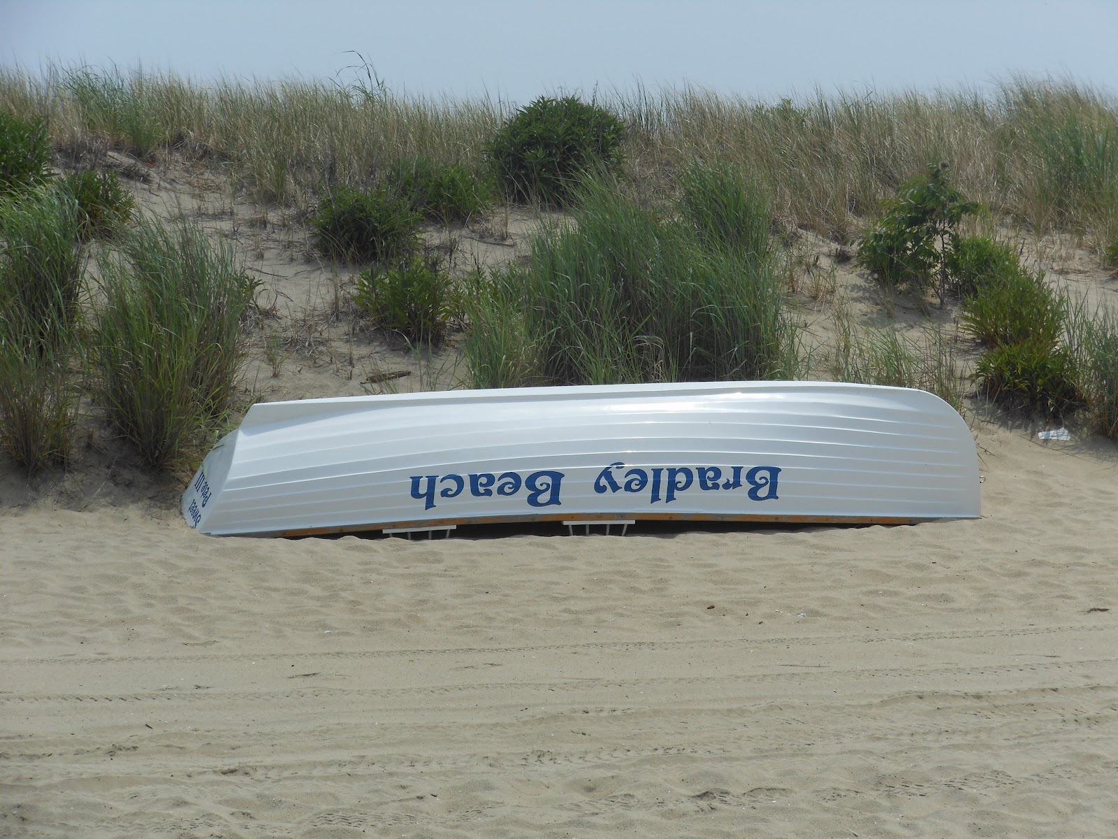


Dunes
How do I know the dunes were man-made? When I was a child we went to Bradley Beach every summer. There were no dunes in those days. 


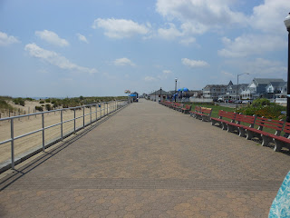
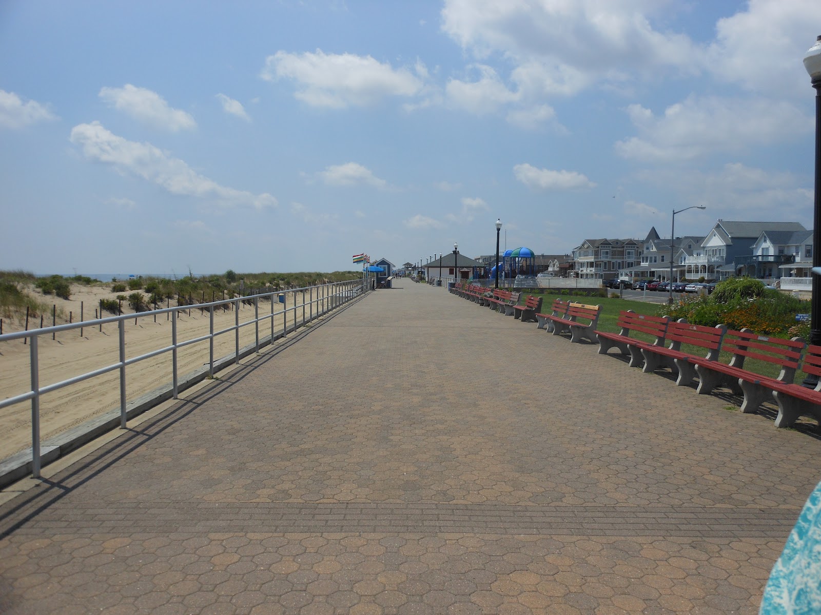
The Bradley Beach "Board" Walk

Other changes: the "boardwalk" in Bradley Beach is no longer made of boards (it's made of pavers) and it is no longer elevated. The single hotel that used to face the boardwalk in Bradley Beach is no longer there. But not much else has changed. None of these towns boast large oceanfront condos or hotels, sit-down restaurants, or any other sort of commercial development along the oceanfront. Just block after block of homes, boarding houses, and a few small inns and condos. There are a few walk-up snack bars along the beach - there always were - but that's it. One other thing that hasn't changed: people still go to the beach here to get tanned. I guess they aren't worried about skin cancer or wrinkles.
Bradley Beach's centennial fountain
The Syrian shul hasn't changed much

Bradley Beach was established in 1893. In the days when I used to go there, it was populated mainly by Italians, Ashkenazi Jews, and Syrian Jews. I have no idea who goes to Bradley Beach nowadays.

After retracing our boardwalk stroll, we turned down a different street in Ocean Grove, passing more Victorians, a cannon from the Civil War, and a nasty, muddy lake with swan boats, dragon boats, flamingo boats, and so on. I don't know why the walk route didn't follow the boardwalk a few blocks further into Asbury Park where there used to be an arcade, rides, booths selling Italian ices, and the general atmosphere of a carnival.  Perhaps because most of that is gone now?

I had two concerns with the directions. First, right at the beginning of the walk you are told to turn on Emory Street, but this was obviously an error, as there was no street with that name. Second, the start box was in a cafe that was closed on Monday's and Tuesday's. IMHO, that is not a suitable location for a start box.

P.S. - We drove back to Bradley Beach after the walk and found my grandparents' house. It has been well maintained. A veranda and balcony have been added. It looks good.


Walk Route: B
Walk Documentation: C

Sunday, July 15, 2012

July 15, 2012 - Princeton (YRE)


I was told that there is no walk in the New Jersey state capital, Trenton, because it is too dangerous. Therefore, the powers that be declared that the Princeton walk would count as the capital walk for the state of New Jersey.  Good call! Princeton is a lovely town.

We started in Marquand Park and then walked through a charming neighborhood made up of large, stately homes. Next, we visited an old cemetery where both Grover Cleveland and Aaron Burr are buried. We continued on through the small, but appealing, center of the town before arriving at the campus of Princeton University.


Monument to Battle of Princeton, 1777
Lewis School


The campus is an iconic Ivy League campus. The majority of the buildings are in the Collegiate Gothic style, each one more spectacular than the last. The campus includes a collection of modern art sculptures, an art gallery, a theater, sports venues, as well as several construction sites.


Prospect House Gardens


 This walk had several options: 5k town/university, 5k battlefield, 10k town/university, 10k town + battlefield, and 15k town/university + battlefield. (I walked the 10k town/university route.)

There was one thing that marred an otherwise fantastic walk. The walk box was supposed to contain a sheet of historical notes, in addition to the route directions and maps. There were no copies of the historical notes, and I was EXTREMELY disappointed by this because Princeton has SO MUCH history. We walked by an awful lot of interesting homes and buildings and had no idea what they were.  This is not the first time I have experienced this type of problem. It is disgraceful that someone will take the last copy, or the next to last copy, or even one of the last five copies and not, at the least, report it to the POC. But really, folks, if there is only one set of notes or directions left, bring it back when you are done with the walk -even if it is a remote start, as this one was. It may be an extra 5 miles for you, but I came 3800 miles from Alaska to do this walk, and I don't appreciate your selfishness and lack of consideration.

A few suggestions for the POC: 1) Check on your box often, especially if it is a state capital walk or another popular walk. 2) Put a permanent copy of each walk document in a plastic sleeve inside the start binder and mark it "Do Not Remove." Maybe someone will take it anyway, but maybe they won't. 3) Don't put historical notes on a separate sheet. Put the information into the walk instructions. 4) Put it on the Internet.  5) Why can't you put out more instructions or notes in the first place? What costs more - 25 (or 50) additional copies, or the gas to drive out and restock the walk box?

Walk Route: A+

Walk Documentation: D