 |
| Fort Caroline - a French presence in Florida in the 1560's |
Our 10K walk started at the Timuacan Preserve Visitors Center in the Timucuan Ecological and Historic Preserve, where we were helped by a very friendly park ranger. The Visitors Center has some good exhibits is adjacent to the site of Fort Caroline. Fort Caroline was France’s attempt to colonize what is now Florida. It was established in 1564 on the banks of the St. Johns River, and was named “LaCaroline” (Land of Charles) after King Charles of France. This venture lasted a little over a year, succumbing to starvation, mutiny, and, ultimately, attacks by the Spanish.
We started out at the fort. Actually, it is a 1/3 scale replica of the fort. There wasn’t anything inside beyond a few cannon, so we quickly proceeded to a nature trail.
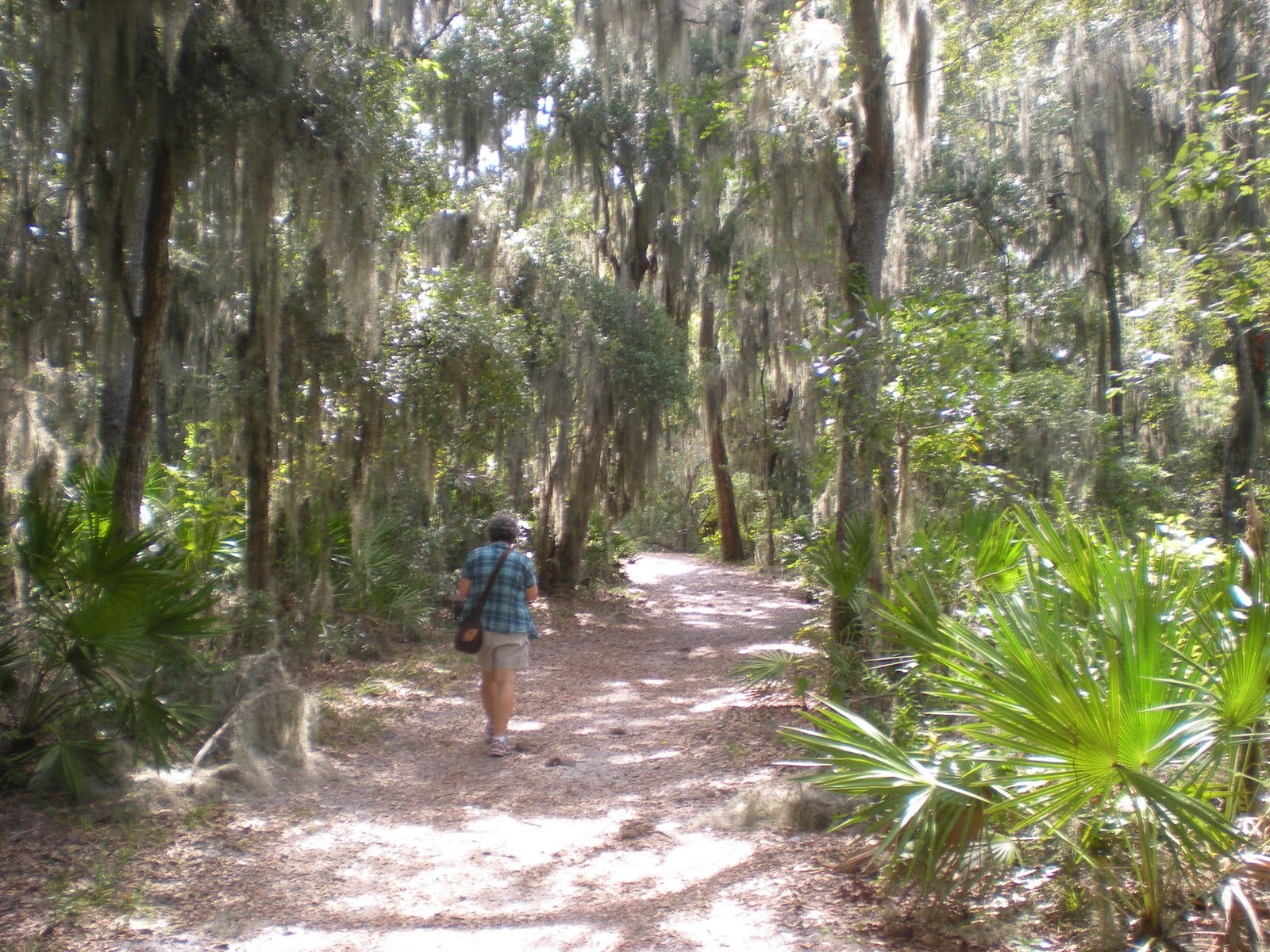 |
| Oh, yeah! Spanish Moss! |
The nature trail was pleasant and had several informative signs explaining the local habitat, which is known as a “maritime hammock.” (Maritime Hammocks are wet hardwood forests found between uplands
and wetlands with a diverse understory of woody species and broad leafed
evergreen trees and shrubs. Maritime Hammocks are heavily influenced by
salt spray from the ocean.) This area was full of live oak trees festooned with Spanish moss, long-needle pines, sabal palms, saw palmettos, red cedar, hickory, and ferns.
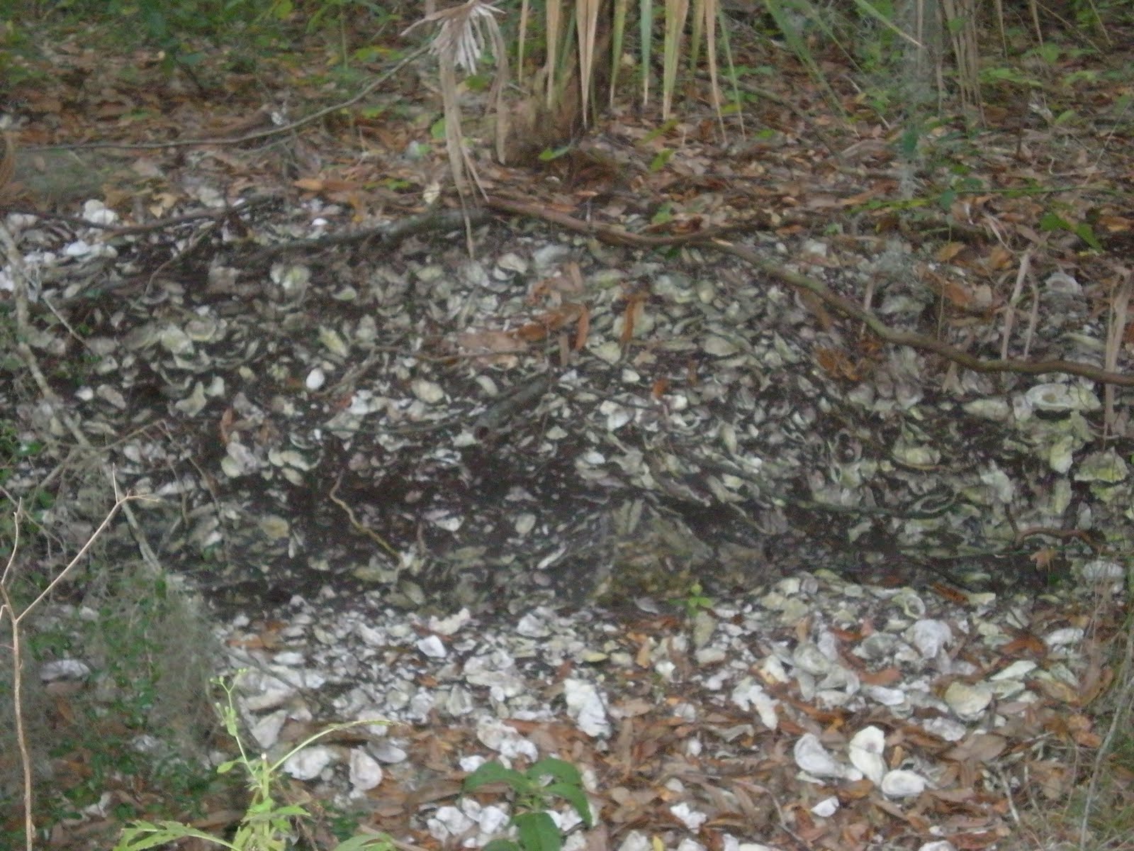 |
| Shell Midden |
The area was inhabited by the Timucua, an indigenous people that is now, unfortunately, extinct. The Timucua are believed to have inhabited this area for at least 4,000 years prior to the arrival of Europeans. They had a diet consisting mainly of oysters and shellfish. During the course of our walk we encountered a great number of large shell middens. These mounds of oyster shells were the “garbage heaps” discarded by the Timucua.
 |
| St. Johns River |
In all, about 95% of the walk was on trails in the Nature Preserve. (You would be well-advised to bring insect repellent with you.) Our walk continued along the Spanish Pond Trail to the Timucuan Trail. At the Round Marsh Observation Platform we enjoyed a great view of the St. Johns River salt marshes. The final segment of the walk took us through the Theodore Roosevelt Area. We only saw two other people during our walk. We did see a few interesting animals, birds, and insects – most notably, some tortoises. One tortoise was about the size of a half volleyball (and it could move pretty fast). We also saw hundreds of tiny crabs, about the size of a quarter.
 |
| You're a lucky one. You could have been a comb! |
After the walk, we took a short drive to see the Ribault Monument. This is included in the 5K walk, but not in the 10K walk. It is worth going to see it.
Rating:
Walk Route: B-
I would suggest including the Ribault Monument in the 10K route and eliminating some of the walk in the Theodore Roosevelt Area. It was way too much hammock habitat.
Walk Documentation: C
The map was not very easy to read. The instructions should have included distances. While we did not get lost, there were a number of times that we worried that we might be lost, because we had no idea how far it was to the next landmark.