Friday, June 20, 2014

June 20, 2014 - Columbia River Gorge Biennial Classic - Starvation Creek

Our 10k walk today started 12 miles west of Cascade Locks. It was drizzly, overcast and cool as we drove past misty, mystical mountains with wisps of clouds curling up from their slopes.

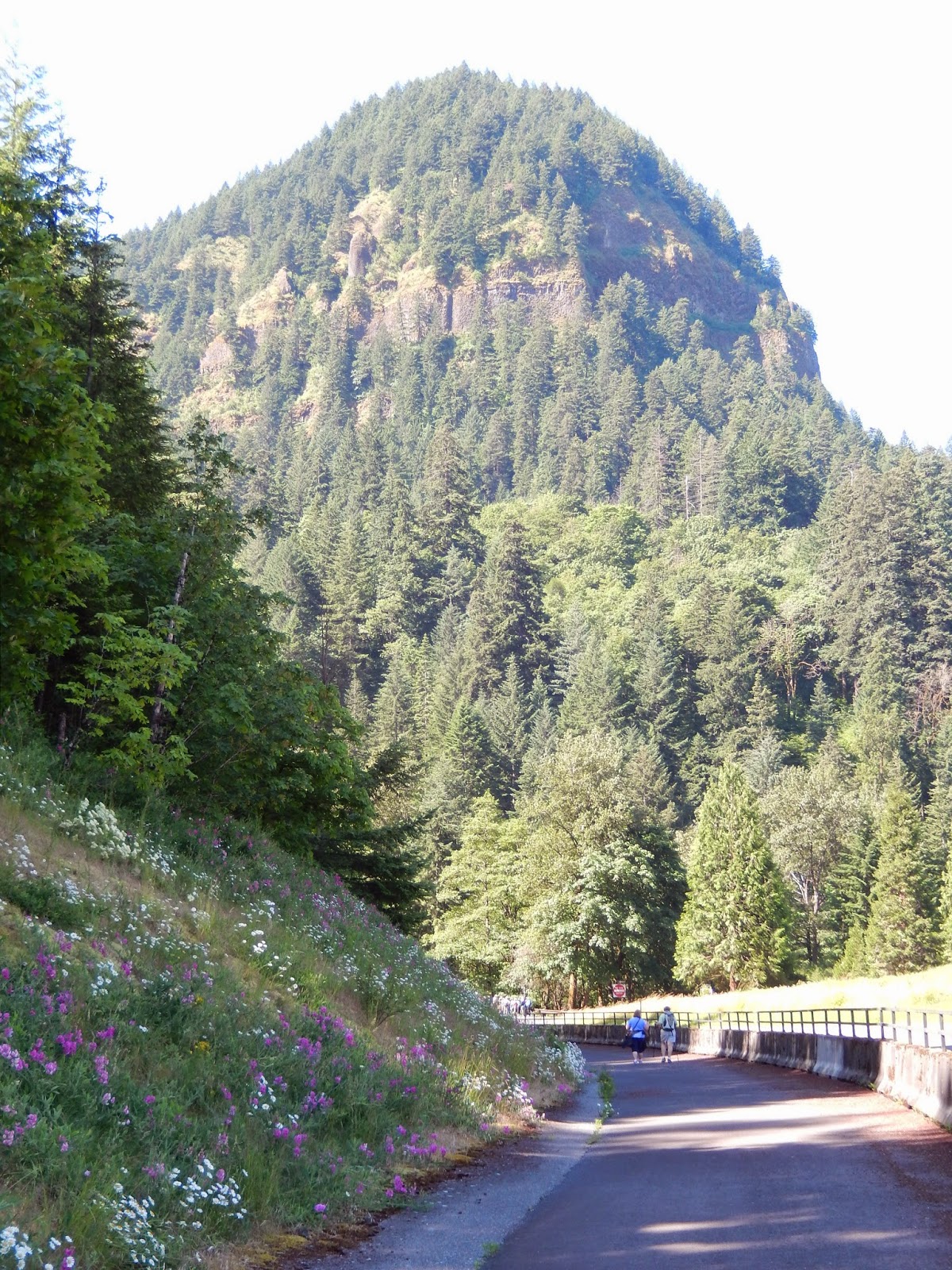
We arrived at the trailhead before the guided group and decided to get a head start so we wouldn't be too far behind at the end. It was cool and lightly spritzing, but comfortable for walking. The first mile was a gentle uphill walk on a paved path that used to be US 30, the historic Columbia River Highway. 

The trail follows the historic Columbia River Highway, now replaced by I-84
Ken saw an Ewok here
 After a little over a mile we came to a short side trail that led to a waterfall. This was Starvation Creek. We learned from an interpretive sign how this location got its name. Spoiler alert: nobody actually starved.
Starvation Creek Falls
Starvation Creek
On December 18, 1884, the Pacific Express left The Dalles with 148 passengers and crew, scheduled to arrive in Portland later that day. Instead, they were trapped between avalanches, unable to proceed in either direction. A relief party finally reached them on Christmas Day by foot. Workers labored to open the line to Portland. Only on December 30 did a train break through from The Dalles and on January 7, the Pacific Express finally reached Portland, three weeks late.
At the Starvation Creek parking lot we saw one thing Oregon is doing to prevent the spread of invasive seeds: boot-cleaning brushes and signs!

We continued on the trail past some people on a bulldozer (who may have been taking soil samples). Right after that we came to a small moss-covered mound. It was a stone oven used by Chinese laborers to bake bread while they were building the Old Columbia River Highway (built between 1913 and 1922). Shortly thereafter we came to a larger mound that was not moss-covered. This mound was an anthill. I don't know if it is still active.
The Chinese oven
The anthill
After coming to a third major waterfall, we turned around and retraced our steps back to the parking area. 
Saved by the safety fence
Trains still go by the Starvation Creek area
Rocks and ferns
From the parking lot we headed to Viento Park, on the other side of I-84. This was a pleasant campground and day-use area. The cedar trees gave it a wonderful smell. We took a short path down to a rocky little beach. If you go, don't forget to bring a towel so you can soak your tired feet in the river. I didn't have a towel, so I kept my shoes on and just admired the splendid view.


Wildlife sightings:
     - 1 chipmunk
     - 1 really large, really ugly slug
     - 1 Daddy-long-legs
     - some birds

Walk Route: A-
Walk Instructions: C ((Would like more detail, names of waterfalls, distances. Directions were a little confusing at 10k turnaround point and at beginning of leg going to Viento Park.)

Thursday, June 19, 2014

June 19, 2014 - Columbia River Gorge Biennial Classic - Wahclella Falls

Here we are in Oregon for the Columbia River Gorge Biennial Classic.

After about a 40 minute drive from East Portland, we arrived in Cascade Locks. It was a beautiful drive along the Columbia River. Or should I say "gorge-ous"? We found our way to Marine Park, the headquarters for the 13 walks and 1 bike ride that make up the CRGBC.

Marine Park lies right next to the Columbia River. There is a beautiful statue of Sacagawea in the park. She joined Lewis and Clark's expedition when her son was 2 months old. She was "married" to a French trapper and was probably about 17 years old at the time of the expedition. She served as an interpreter, having grown up among the Shoshone until about being kidnapped by Hidatsa when she was about 12. Her presence let the locals know that Lewis and Clark's expedition was peaceful and friendly.
Sacagawea and Meriwether Lewis' Newfoundland dog
The registration for the walks was well-organized. They even had a greeter. In addition to registration, there were some tables where you could buy merchandise and pick up leaflets for upcoming walks.

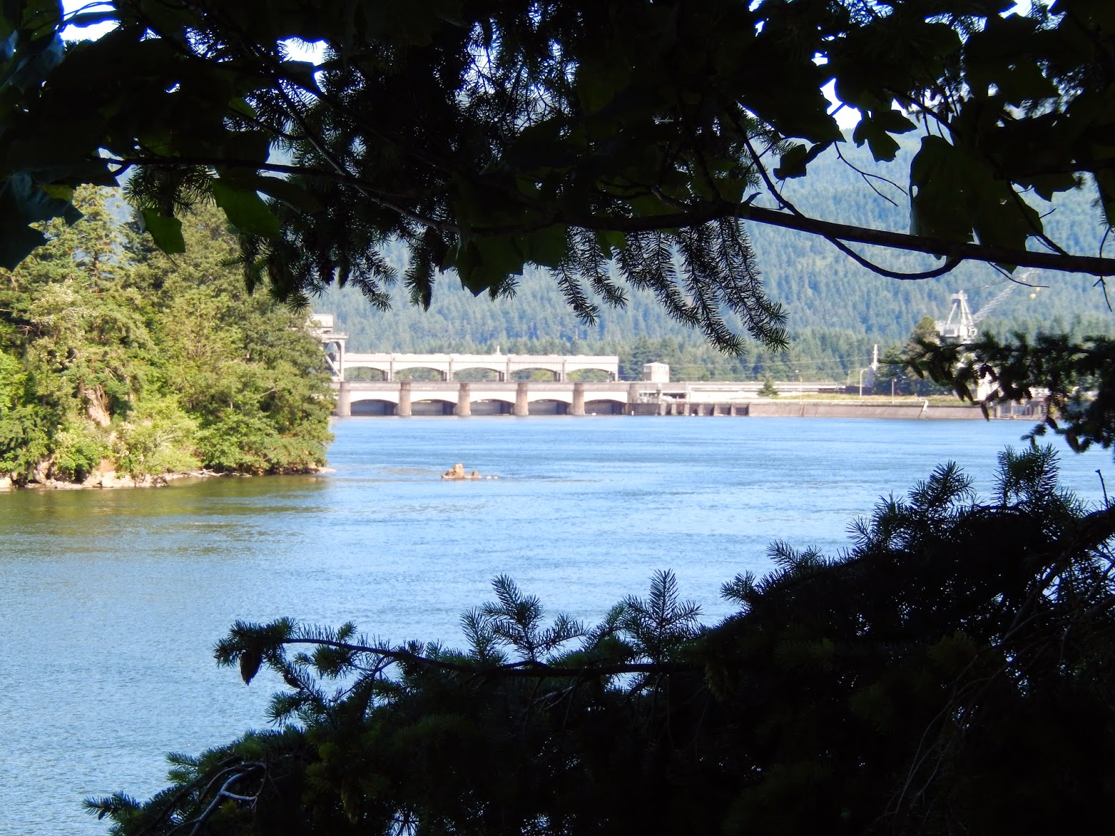
Today we opted to join the guided 10k walk to Wahclella Falls. There were about 45 people in the group. First we had to drive about 5 miles to the Eagle Creek Campground. From that point we had a good view of the Bonneville Dam, the locks, and the old and new powerhouse.
The Bonneville Dam


The Bonneville Lock
The new powerhouse

Wikipedia tells us about the early days of the dam (with some editing by me): 

"The folk song, Roll On, Columbia, Roll On, was part of the Columbia River Ballads, a set of twenty-six songs written by Woody Guthrie as part of a commission by the Bonneville Power Administration, the federal agency created to sell and distribute power from the river's federal hydroelectric facilities. At the time, the agency was facing a controversy because several counties in Washington and Oregon had begun construction of their own dams on the Columbia, outside of the federal jurisdiction. The BPA hired Guthrie to write a set of songs about the federal projects to gain support for federal regulation of hydroelectricity.

As part of the effort, Guthrie, who was from Oklahoma and knew little about the Pacific Northwest, was driven all around Washington and Oregon to gain inspiration from the Columbia and its tributaries. Guthrie was glad he was able to tour and get a feel for the area, commenting that "these Pacific Northwest songs and ballads have all got these personal feelings for me because I was there on these very spots and very grounds before."
Of the Columbia River Ballads Roll on, Columbia,  was by far the most popular. Because of the song's message and popularity, it was established as the official folk song of Washington in 1987." 

Click below to listen:

Roll On, Columbia, Roll On

The Walk

We walked about 2.5k on a paved trail through some pleasant woods along the highway. There was one long set of stairs, so this walk was not suitable for strollers, wheelchairs, etc.


After 2.5k we arrived at the trailhead for Wahclella Falls, but first we took a detour to the Bonneville Fish Hatchery. I wish we had more time to explore this site. There was a museum and gift shop, as well as some charming historic buildings. And, of course, the fish hatchery operations. We saw very small trout in one pond, and large rainbow trout in another. We also saw a pond inhabited by huge sturgeon. It looked like they had been fed pieces of salmon. There was another place where you could go below the level of the pond and see inside one of the tanks. We saw lots of sturgeon there, and one of them was scary big. There was also lots of fish-themed art on the fish hatchery grounds.
Big cedars at the fish hatchery
A sturgeon weather vane

Sturgeon
Rainbow Trout
The trail to Wahclella Falls took us a mile down a canyon. The scenery here was splendid: moss-covered logs, ferns, crystal clear water, wild flowers. There was a fresh, balsam-y forest smell. It was a hard walk, but worth it. When I registered for this walk, it was listed as 2C. This morning it was listed as 3C, which was probably more accurate, but might have deterred me from signing up for this particular walk.

Wahclella Falls
A lot of people we met on the trail had dogs with them. In all but one case, they were obeying the posted leash law. There was also a woman in the volkswalk group who had a pet carrier backpack. It had a parrot in it. Really. Insert your favorite pirate joke here. 

From the falls we retraced our steps, skipping the side trip to the fish hatchery.
Roll on, Columbia!
Upon our return to Marine Park, we availed our self of the hot dog lunch offered by the Columbia River Volkssports Club for $3: a Polish hot dog, chips, cookies and a drink. It was great to sit down in the sun and look at the river.

Special thanks go to Dick B., our guide, who was very patient with me and the other slowpokes.
Walk Route: A-
Walk Instructions: C+ (It would be nice to have more detail, especially indications of the distance traveled every km or two. Putting cell numbers on the instructions was an excellent idea.)

Tuesday, June 17, 2014

June 14, 2014 - Trail of Blue Ice


Trail of Blue Ice

We drove down the Seward Highway to the Begich, Boggs Visitor Center in Portage Valley for a regular volkswalk on the Trail of Blue Ice. This trail is named for the blue ice that can be seen in glaciers. The trail connects several glaciers in Portage Valley including Explorer Glacier, Middle Glacier, and Williwaw Glacier.

We started at the visitor center and walked past Portage Lake on a very nice improved trail. The trail was fairly flat. The first part was paved, and then we turned onto a gravel trail to follow the Williwaw Nature Trail. We saw many lovely wildflowers along the side of the trail, especially lupine and columbine.
Columbine


We were going to turn around at the 2.5k point, which was a sign reading Williwaw Ponds.  However we missed the sign and continued past a beaver lodge until we reached a bridge and realized we had gone too far. Apparently the sign had rotted and fallen off the sign post and you could only see a remnant of it when you were coming back in the other direction.
A glacier

Bear-proof trash can
 Not finished . . .

Monday, April 7, 2014

April 7, 2014 - Honolulu (YRE)

We docked right by the Aloha Tower. We couldn't have been closer to downtown Honolulu. In fact, the ship was closer to downtown than the clock tower is.
The plan for today was to do the state capital volkswalk. We picked up the walk route right there at the clock tower. After a few blocks we reached Honolulu's vibrant Chinatown, with its exotic food markets. We bought some almond cookies at a little hole-in-the-wall bakery.

We walked past a number of historic buildings in Chinatown, then past a Chinese temple to a botanical garden. From there we walked to the YMCA where the volkswalk officially started. Our route continued past a Catholic cathedral built in 1843 of coral blocks from the harbor. The we passed St. Andrew's Episcopal Cathedral, built in 1867 in the English Gothic style, on the site of the home of King Kamehameha III. Polynesians have probably lived in Honolulu since 1100 CE. King Kamehameha I united the islands in 1795.(Write your own editorial here.)

Washington Place was the home of Queen Lili'uokalani from the overthrow of the Hawaiian monarchy until her death in 1917. It was not open to the public. I would have liked to see it after having read about it in "The Last Aloha." Shortly thereafter we passed the Queen's Medical Center, founded by Queen Emma and King Kamehameha IV in 1859.
Finally, we arrived at the State Capitol building. It was built in 1968 and featured an open design with symbolic elements representing the volcanic origins of the islands, the ocean, palm trees, blue skies and tradewinds blowing through the open courtyard. I found the building confusing, unwelcoming and unattractive. I have now visited 37 state capitols. Most are some variation on the Bullfinch dome theme and clearly state "I am a Capitol." Many have an information desk and in some guided tours are offered. This building didn't even have an obvious entrance. You went into the courtyard and there was an abstract mosaic on the floor in the center, but no explanation as to what it represented. There were elevators on the sides, but you didn't really know whether to go up or down to get to the main part of the capitol. Maybe there was no main part. Signage was very minimal and we had to ask to find even a restroom, which was hidden in a back passageway. I think a state capitol building should be more accessible to the public. You should be able to easily find the legislative chambers and you should not be made to feel that the elevators and restrooms are not for public use.

We then walked past several government buildings to the Honolulu Art Museum and Thomas Square, a large park that appeared to have been colonized by homeless people. Continuing on, we saw the performing arts complex. Then we walked through a high-rent district where we saw dealerships for Lamborghini, Ferrari, etc.  before reaching a missionary house/museum (more coral blocks). Next came the Kawaihao Church, built by the missionary Rev. Hiram Bingham, whose grandson, Hiram Bingham III, discovered Machu Picchu.  Then we saw the Territorial Office Building, the Judiciary Building, and the King Kamehameha statue, honoring the king who unified the islands.
Across the street stood Iolani Palace. Iolani Palace is the only true palace in America. The 4-story Italian Renaissance building was built between 1879 and 1882.


 . . . to be continued


Good Night Honolulu!