Saturday, August 20, 2016

August 20, 2016 - Blueberry Festival

Oops.  It's been a while since I have posted. I have been traveling a lot in places where they don't have volkswalks. But I'm inspired by today's great walk.

Our club decided to do a group walk or guided walk on our Girdwood YRE. We picked today because the Blueberry Festival is taking place. We used to have event walks during the Blueberry Festival, but it got to be too much work to organize that, so we are accomplishing almost the same thing by walking the YRE.

We brought Merle with us. She is visiting here from Pennsylvania and wanted to get out of town today. This was her first experience with volkswalking, and I think she had a good time.

On the way down to Girdwood we saw a pod of Beluga whales in Turnagain Arm. It is so much fun to see them, but it's hard to take pictures from a car going 60 miles an hour.

We arrived in Girdwood after a 45-minute drive and headed for the Alyeska Resort, our start point. About 20 people showed up to walk. Upon starting we divided up into two groups - one to walk the 10k, and one to walk the 5k.

The 5k walk follows a little woodsy trail along a creek, eventually arriving at a gravel airstrip. The weather was absolutely beautiful and we had stunning views of mountains and glaciers.

We continued through a subdivision where we admired some homes with gorgeous flower gardens and lots of charming cozy-looking cabins.

Eventually we reached the main road and crossed over to the Jade Shop.
Approaching the Jade Shop
A  trail behind the Jade Shop took us over a silty, glacial creek, and there were more views of glaciers.


We soon arrived at the Alyeska Bake Shop where we were greeted by a bounty of flower pots, boxes, and hanging baskets.


Part of the 5k contingent
Finally, we followed the bike path back up the road toward the Alyeska Resort. We started to pass blueberry bushes, but there were very few blueberries to be found.

As the bike path led us through a tunnel to another trail near the back of the resort we began to see little groups of blueberry pickers. There were a few berries right by the side of the trail that no one had found yet and we ate them!

Very soon after that we arrived at the resort. The walk was now over but it was time to explore all the booths that had been set up for the Blueberry Festival.

I got a quesadilla at one of the booths. (I am writing about this to remind myself not to go to that booth next year. The quesadilla was not that good. While I was waiting for it, I watched a customer walk up to the counter, reach over and stick her hand into a bowl of shredded cheese, and grab a handful to add to the plate of food she had just purchased. This was the cheese the cooks were adding to people's food. She was not supposed to take any, and she was definitely not supposed to stick her hand into the bowl of cheese. I was horrified because I could see what she was going to do and I yelled "No, no, no" but she did it anyway. I told the people working there and they said customers are not supposed to touch the food and I said yes, but they are doing it, what are you going to do about it? I suspect they have not changed the way they operate.)

By the time we left the Blueberry Festival, there was a huge traffic jam trying to get into the parking lot. There was a line of cars backed up all the way from the Resort to the "T" and from the "T" all the way down to Crow Creek Road. Make sure you go EARLY if you go next year.

Route: B+ if you do this YRE on a gorgeous day during the Blueberry Festival

Sunday, July 26, 2015

July 25, 2015 - Trail of Blue Ice

We enjoyed the sunshine on the hour-long drive down to Portage. When we got about a mile away from the Begich Boggs Visitor Center, it got cloudy, windy and cold. That's the way the weather always is there - unless it's raining. Between the mountain pass and the glaciers, there is a micro-climate there that is fed by the cold blue glaciers in the area.

We started out from the Visitor Center and picked up the Trail of Blue Ice at the other end of the parking lot. It is an improved trail and it's very pleasant once you get away from the cold wind coming off the lake. That happens in less then five minutes. :) In fact, after a few more minutes I was quite comfortable in shorts and a t-shirt.

The trail beckons
A mossy rock

Our walk was fairly uneventful.  There were two club members who encountered a bear on the trail, but we didn't see any wildlife at all, so we had to make do with observing the local flora.


Fireweed


The nagoonberries were ripe, and we stopped to sample some with some other club members. They are similar to raspberries, but "seedier."


We did manage to see some of the "blue ice" despite the clouds. The ice in glaciers looks blue because it is compressed to the point where it is very dense and all of the light waves in the spectrum except for the blue frequency are absorbed.
You can just see a blue glacier on the left, peeping out from under the cloudy mountain top. You had to be there.
It is very calming to be able to spend time in a wild, beautiful environment with very few people around.


When we got back to the Visitors' Center, we used our Golden Age Passport to get into the exhibits and the movie. I accidentally sat on a giant ice worm. I thought it was couch. Yes, ice worms are a real thing, and they sometimes have some on display, swimming around in a bucket of ice water.
Me and my new best friend
A typical Alaskan mosquito

Walk Route: B+
Walk Instructions: B+ 
I like instructions that give the distances at each landmark.

Tuesday, March 24, 2015

March 24, 2015 - Santa Fe, NM

Santa Fe is small but very interesting. You may want to allow a lot of time for this walk because there is so much to see. You might also want some extra time because the altitude is 7,000 feet.

There must be a strict building code here. There are only a couple of buildings that are more than two stories tall. Almost everything is in the Pueblo Revival style - public buildings, commercial buildings and residences.
The Inn at Loretto - an example of Pueblo Revival
Kate and I started out by crossing the Old Santa Fe Trail. At one time, Route 66 followed this trail, but in the 1930's Route 66 was realigned to bypass Santa Fe.

We soon arrived at the State Capitol building. It is built in New Mexico Territorial style - an adaptation of Greek Revival and Pueblo adobe. 
The Roundhouse


The Capitol building is nicknamed "the Roundhouse" and resembles a Zia sun symbol when seen from above.
The Zia Sun Symbol on the state flag
There is a wonderful art collection inside the Capitol, and many pieces of public art can be seen on the Capitol grounds as well as here and there throughout downtown. Many are by emerging artists.

This abstract piece reminded me of red hot chili peppers


"When Friends Meet"
The Santa Fe Plaza, a National Historical Landmark, now serves as the focus for art, jewelry, music, and especially Native American culture.
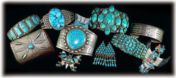
There are lots of art galleries, jewelry shops, cafes, and high-end stores in this area. The turquoise and silver Navajo jewelry is everywhere and it is stunning.
There are many reminders of New Mexico's Native American heritage, but there are also reminders of it's Wild West history. Both Kit Carson and Billy the Kid are commemorated in Santa Fe.
We detoured about half a block to visit the Georgia O'Keeffe Museum. It is well worth the extra time. Be sure to see the short documentary about her life.
O'Keefe's work often featured flowers or southwestern landscapes, or both
We also made a stop at the Museum of Indian Women in the Arts, where we learned about the work of Pablita Velarde and her daughter and granddaughter.
Pablita's work was colorful and showed Native American themes

St. Francis Cathedral is a Romanesque Revival structure that can be seen from many parts of downtown. The keystone in the arch above the main entrance contains a triangle with the Tetragrammaton in Hebrew carved in it. An "old story" suggests that this was Fr. Lamy's way of thanking various local Jewish merchants for their financial contributions towards the building of the cathedral.

In front of the cathedral is a statue of Kateri Tekakwitha, the first North American Indian to be canonized. (She was from New York state, not the Southwest.)
Saint Kateri

San Miguel Chapel, the oldest church in the US
Between museums and shopping and lunch we only had time for the 5k, but I feel like I got a very good introduction to Santa Fe.
I agree with the saying about New Mexico: It's not actually new and it's not actually Mexico. (But it is actually worth seeing.)

Route:  A-

Route Instructions: C+
The directions were confusing in a few places. You couldn't use the map to clarify where you were because the street names often did not appear on the map. There is so much of interest along the route. It would be most appreciated if the instructions provided a little more narrative about historical landmarks.

Saturday, September 6, 2014

September 6, 2014 - New Campbell Creek Trail


Today’s event occurred on a beautiful early fall day. The temperature (55-60°) was perfect for walking.

We started out at the Sourdough Mining Company, as we have done for past YRE’s and regular events on the Campbell Creek Trail. However, instead of turning left onto the trail, we turned right onto a new segment of the trail and followed the Campbell Creek Greenbelt to the east.

While walking through a pleasant wooded section of the trail, we noticed how high Campbell Creek was, due to recent rains. Then we began to notice that the pavement was covered with hundreds of tiny slugs. It was hard not to step on them because there were so many of them. Yuck! At least they were tiny – not like the HUGE ones we saw on our Columbia River Gorge walks.

We crossed Campbell Creek using a nice wood pedestrian bridge and continued following the trail under four overpasses of the Seward Highway. There were some screens next to each underpass to keep snow from the snowplows from falling on the trail in the winter. They had nice designs of people enjoying outdoor activities. Too bad some lowlife felt the need to slash several of them.

Side view of Campbell Creek from the viewing platform

Soon we came to a short side trail leading to a viewing platform. We went down this trail to get a better view of Campbell Creek. Unfortunately, the trees have grown quite a bit since the platform was built, so it was hard to get a good direct view, but you could see the creek from the side.

Soon we came to Waldron Lake. Our kids used to play soccer here (a long time ago) and it looks like the field next to the lake is still used for soccer. We saw Canada geese, mallards, and other types of ducks in the lake.
Waldron Lake
The trail ended at an older subdivision. After two short blocks we came to Lake Otis Parkway, a very busy street. We had to go south for three blocks to the pedestrian tunnel under Lake Otis. On the way we encountered some other walkers who told us the tunnel was a mess. We decided to cross at the crosswalk instead, using the pedestrian walk signal. After crossing we had to go north for three blocks to get to Campbell Park. This is a popular park with a recently renovated playground. The new play structures were very colorful and looked like a lot of fun, but I forgot to take pictures.  :(

I forgot to take pictures, but I found this one on the web. Pun intended.
After making a big loop around the playground, we headed back to the start point, while the 10k walkers continued along the trail to the animal shelter.

Under the Seward Highway
Walk Route: B-
It’s always great to have a new route. The trail was very enjoyable, but the segment from 47th to the playground was noisy and uninteresting, as was the segment under the four sections of the Seward Highway. 


Walk Instructions: B+
Extremely clear and precise instructions, but no map, no distance indications in the directions. Also, directions are easier to follow when they are numbered.

Friday, August 22, 2014

August 21, 2014 - Culpeper, VA - Streetscapes YRE


Wow! Culpeper is a wonderful little town with lots of history and lots of curb appeal. It is in North Central Virginia, about a 2 hour drive from Bethesda, but worth it. 

In 1749, 17-year-old George Washington was commissioned to survey and plot the town and county of Culpeper. In 1759, the town of Culpeper was chartered. During the Revolutionary War, the Culpeper Minute Men fought in a battle at Great Bridge. 

During the Civil War, Culpeper's strategic railroad location made it a significant supply station for both Confederate and Union troops. Culpeper County witnessed more than 100 battles and skirmishes during this period.

In the 20th century, construction of a highway bypass around the town pulled commerce and industry away from the once thriving town center. After years of decline, the town established a program to revitalize its downtown. In 1987 CUlpeper became a Virginia Main Street Community. Through hard work and dedication, Culpeper has become a vibrant town.
Our walk started at the Visitor's Center in the old Depot. The VC was well-stocked with helpful maps and other information and the staff was friendly and helpful, too. 

Many of the structures in Culpeper date to the late 1700's and early 1800's. The downtown Historic District features commercial many brick buildings of the vernacular, Italianate, and neo-classical styles. We started our downtown tour on Davis Street. What a great street! It ws full of restaurants, shops, inns, and even an old-fashioned hardware store. There was not a single chain store, restaurant or hotel downtown.

The Culpeper County Courthouse was built between 1870 and 1874 after an earlier courthouse was torn down.
Several veterans monuments are located near the courthouse.
One remarkable thing we noticed was how friendly the locals are. So many people said hello to us as we walked through their neighborhoods.

I have a lot more to say and a lot more photos, so I will continue this soon. Chec k back in a week for an update.

Tuesday, August 19, 2014

August 19, 2014 - Bethesda, MD: Cabin John Park YRE

Due to severe jetlag we opted for the 5k walk today. A 10k walk is also offered here.

The Start Point

The start point was at Aroma Espresso Bar in Montgomery Mall. In the winter or on a rainy day you can do this walk inside the mall. There are directions for it. It's a wonderful mall to shop in, too. We bought some sandwiches at Aroma to take with us on the walk. They were really good. I would go back there just for more sandwiches (or a salad, or a dessert, or whatever).

We didn't pay attention to the driving directions on the AVA website because we knew where the mall was. As a result, we didn't notice the very specific instructions about which mall entrance to use. Not surprisingly, we used the farthest possible entrance from Aroma, and probably walked another kilometer getting there and going back to our car.

The Walk

It is a short drive to the Cabin John Park and Ice Rink, where the walk actually starts. This is a terrific park, with woods, creeks, and trails; with indoor ice rinks and tennis courts; with outdoor ballfields and tennis courts; with a miniature train (we didn't see it); with a log cabin of historical interest; and with a very nice nature center and natural gardens.

We got onto a dirt rail about 5 minutes into the walk and stayed on dirt trails throughout the walk. The trails were rocky and rooty and hilly in places, making this walk a 2C. It was also rather buggy, but I had Off with me. The trails lead through pleasant open hardwood forest. The trails are well marked, with carved wooden signs and blazes on the trees. There are rustic bridges over the creeks and a few benches, but few other improvements. I didn't see much wildlife - a bluejay, some type of dove, and a few ordinary-looking brown birds. According to signage at the Nature Center, there are also some beavers, turtles, and harmless black snakes. I did see a small fish in the creek.

We didn't find the trail very busy on a weekday afternoon. We passed three dogwalkers, three or four joggers, a couple of mountain bikers, and a couple of other walkers. Dogs are required to be leashed and two of them actually were.

The Sycamore Tree Incident

About halfway through the walk we came to a lovely meadow with wildflowers and a birdhouse. The walk instructions told us to notice the beautiful large sycamore tree at the far end of the meadow. There were a couple of picnin tables and a small amphitheatre there. It was a lovely spot, except for the two underparented children, around 5 and 8, who had pulled one of the sycamore branches down. They were hanging on it and pulling leaves and seedpods foff. It looked as though they might break off the branch. I didn't see any adults around, although I could hear a strange cracking sound coming from the nearby woods, so I told them to let go of the branch because they were hurting the tree. They looked at me like I was from Mars. I repeated it. Nothing happened. One more time I said: "Let go of the tree," a little bit louder, and they reluctantly did. We walked on afew steps and then a man's voice started yellow at me: "Let go of the tree? Are you serious? Why don't you go back to your concrete building?" And so on. I was worried the confrontation would escalate, so we walked quickly away and I didn't get any photos of this magnificent tree, which was probably a couple of hundred years old. I felt very angry that some man would leave his children alone and then verbally attack me and accuse me of not caring about nature after he his children had blatantly disrepected nature. I also suspect that the cracking noise in the woods came from something he was doing that he shouldn't have been doing. End of rant.

Photos to be posted soon!

Walk Route: B 
There was more to see here than I expected.

Walk Instructions: A
Extremely clear and specific directions, keyed to the map.

Sunday, August 3, 2014

August 3, 2014 - Haines, AK (Seasonal)

The weather was fabulous. It was shorts weather, at least for these Alaskans. So we put on sunblock and headed off the ship at 7:30 am. Today the Haines Skagway Fast Ferry was operating on its more limited Sunday schedule, so our plan was to take the 8 am ferry over to Haines and come back on the 1 pm ferry.

The ferry is a catamaran that travels at a speed of 22 knots.
It has its own dog (Lulu), a small crew, and free coffee. One of the crew members, Jess, welcomed us on board with singing. He entertained us during most of the 40-minute trip by singing sea chanties, pointing out waterfalls and other noteworthy sights, explaining the natural history and social history of the area, and teaching us a few words of Tlingit. The scenery was beautiful, too. The ferry ride was not so much transportation as a tour.

Upon arrival in Haines, we began our 5k volkswalk at the dock. The options were a 5k loop and a 9k out-and-back. These walks were sponsored by Dairyland Walkers, out of Wisconsin, and will probably only be available during the 2014 tourist season. The chance to walk in Haines is much appreciated. 

We started out walking along Beach Road, which followed the shoreline. The beach was full of tents, as the Southeast Alaska State Fair is going on in Haines this weekend. We came to a little park overlooking the water, and there were more tents and a camper park. On the other side of the road was an old cemetery.
We turned up Main Street, where the directions said we would find the Sheldon Museum and Cultural Center and the Hammer Museum. It was early and the Sheldon Museum was closed. I thought maybe the Hammer Museum was an art gallery and hoped it would be open. Well, it wasn't open, and it wasn't an art gallery. It was a museum devoted to hammers - as in tools. I would have paid the $5 to go in if it had been open.
We proceeded toward the Visitor Center ( open, and with public restrooms) and at this point we realized that the written volkswalk instructions and the accompanying map had diverged at the intersection of Beach Road and Main Street.

Back to that intersection, adding another kilometer to our walk. We proceeded for a few uninteresting blocks and then climbed a steep hill into a modest but tidy residential neighborhood.
We walked to what seemed like the edge of town, and then zigzagged through a more typical Alaskan residential neighborhood where you could see a lot of junk in yards, a lot of blue tarps, and a lot of houses that needed serious TLC to be rendered habitable.

Arriving at Main Street, we walked through three of the four blocks of downtown. There were some cute shops, all closed on a Sunday morning. The quilt shop was called Material Girls, and the book shop (which I was a little surprised to see here) was called Babbling Book. The IGA grocery store was closed, but it was going to open in 10 minutes (and there was already a line). We decided to buy some snacks there because we were not sure if we would find any place to get food on the remainder of our walk. (We were wrong.)
Main Street: You could shoot a cannon down the middle of the street and not hit anything
Back down the road toward the Visitor Center and onward toward the American Bald Eagle Foundation. Haines is the Bald Eagle Capital of the World. We didn't go in. Not sure if it was even open.

We shortly arrived at Fort William H. Seward, on a hill overlooking the water. It was built starting in 1903   during a time when there was tension between the US and Canada over the border. The buildings were all the same style and the fort was carefully laid out. The result was an installation that is much more attractive than most Army bases. All the buildings were white clapboard with red, blue, or green trim and shingle roofs. They were arranged in a square around a 6-acre parade ground. The officer's houses were really nice vaguely Victorian structures on the highest ground and facing the water. The officers got to bring their families and they could hire enlisted men (cheaply) to work as servants. Their duties consisted mostly of guarding and firefighting. Because it was very remote at the time it was considered foreign duty, so they got extra credit for their "deprivation." The Alaska Indian Arts Center is now in one of the buildings, and there are totem poles and a spirit house in the parade ground area. There were also more tent campers here.

At the end of WWII Fort Seward was decommissioned, and the entire cemetery was moved to Sitka. In 1947 a group of five WWII veterans bought the fort (85 buildings and 400 acres), sight unseen, with the intention of preserving it, living there, and operating small businesses there. Some of these families still live at the fort. These families contributed to Haines by starting what later became the state ferry system, Haines' art galleries and theater, the Hotel Halsingland (located in former officer's quarters), and  and Alaska Indian Arts (located in the former hospital).

It was not far back to the dock. We decided to forgo doing part of the 9k walk and just sat in the sun until it was time for the return ferry. We watched some of the beach campers go swimming in the ocean (Lynn Canal, to be exact). It was a warm day, but it wasn't warm enough to heat up the water much above 40 degrees F. I guess they just wanted to show off all their tattoos. 
The ferry trip back was extremely pleasant. Jess had a whole new act for the return trip. We passed the state ferry, the Malaspina, on the way back. It would seem to be the slow ferry.

The Malaspina
Walk Route: B-
Walk Instructions: F