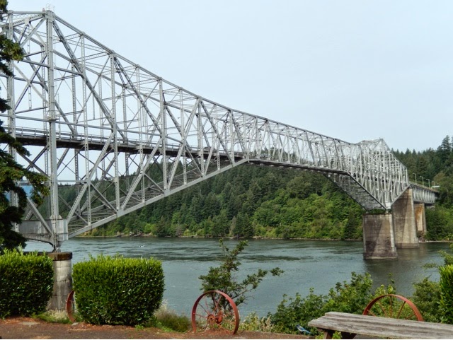
Monday, June 23, 2014

June 23, 2014 - Final Thoughts on Columbia River Gorge Biennial Classic

First, and most importantly, the Columbia River Gorge is spectacular! Go see it if you can. I am thrilled to have had the opportunity to participate in this event. It is very special.

Here is a link to the CRGBC website:

http://www.columbiagorgewalks.com

The CRGBC is not for the faint of heart. Most of the walks are challenging. The 13 walks offered included two 4's and a  5.  I would even say that there weren't enough "easy" walks. By "easy" I mean 1's and 2's, 5k's and 10k's. Not everyone wants to do a 13k walk even if it is a 2.
The event was very well organized, for the most part. Pre-registration was nice and easy, but it would be nice to receive a confirming e-mail. Having one central registration area for all walks worked well. I loved that you had greeters at the registration area. The website was pretty good. The guided walks were a nice idea. The "famous hot dog lunch" was easy, quick, and a great value. I did not participate in any of the social events, so I can't say how they were, but at least the option was there.

Areas where there is room for improvement include trail information and rating, trail instructions, and, in some cases, trail marking.

Trail Ratings:
As I mentioned in earlier posts, the trail ratings on the CRGBC website did not always match the trail ratings on the easel/poster at the registration HQ and/or the trail ratings on the instruction sheets for each trail. This is a big problem. Someone should synchronize the info on the website, the easel and the actual trail instructions. Not everyone is willing or able to do more difficult walks. Perhaps the event organizers could figure out how to measure the cumulative elevation gain and provide that number in addition to the trail rating. 

Some trail distances were also inaccurate. That should be easy to correct.
Trail Routes: 
Most of the 5k routes were boring "out and backs." The Wahclella Falls 5k is a good example. If they moved the start point to the Wahclella Falls trailhead, you could see the falls and the fish hatchery. The turnaround point for the Cascade Locks to Overlook 5k was more like 7 or 7.5 k, and I assume it was done that way so you could see a waterfall. Maybe that 5k walk could start at the outlook. Then you could see the waterfall and the outlook and still do just 5k.

Trail Marking:
Most of the trail marking was excellent. The use of clothespins is a great idea for easy removal of flagging. The color-coding worked well. However, trail marking on the Town walk was poor, and when combined with the poor instructions, it led to confusion in several places.

Trail Instructions:
 

Where are the maps? None of the walks I did had maps. A lot of people process visual information better than verbal information. That is why there should always be both maps and written instructions. It would have been helpful to have a map, just so you can see where you will be going. Especially for the Town Walk, which had poor directions and poor trail marking, a map could have made a big difference.
All of the instructions tended to be vague. It is REALLY helpful if you have some idea of how far the next landmark is. Sometimes it can be 50 feet away and sometimes it can be 2 miles. For visitors who have never been to this area, this can result in constantly second-guessing yourself and wondering whether you should keep going or whether you should have turned around by now. Please give a general indication of when each kilometer has been completed. All instructions should also list the special programs associated with that walk.

The instructions for the Town Walk were particularly bad. We were supposed to go to a sign that said "Learn to Sail Here" and I didn't see the sign or any turn-around marking. On the island we were supposed to follow a path around the island. There was no path, and trail markings were not helpful. After leaving the island we were told to go left at the bottom of the stairs, but the trail markings suggested going straight ahead. This would have been dangerous because of all the people waving their fishing poles around. Then we were supposed to go toward a "white" house. There was a cream-colored house, but no white hose. Again, no turn-around sign. Finally, no turn-around sign at the art studio, which appeared to be closed. This walk would have really benefited from some historical details, information about (and mention of) the Sacagawea statue, information about the quilt trail, etc. The website says this walk goes past the ice cream store. Really? I must have gotten confused by the instructions and lack of a map, because we did not pass an ice cream store. I am positive I can not pass an ice cream store without noticing it. :)

To be fair, I didn't get lost, and I survived all the walks, but I did change my walk for the last day because I was concerned that some of the others had been mis-rated and I didn't want to turn a fun experience into an experience that injured my knees and feet.

Thank you to all the volunteers who helped make this event happen. You all deserve a huge pat on the back for your efforts.


Sunday, June 22, 2014

June 22, 2014 - Columbia River Gorge Biennial Classic - Town Walk

We were signed up to do the Horsetail Falls walk today, but it seems to have gone from a 2C to a 3C with no 5k option. My feet and knees need more time to rest, so today it seemed like a better choice would be the 5k Town Walk, which is rated 1A.

In case you've been wondering, here is what the trail ratings mean:

Part 1 – INCLINE/ELEVATION

Part 2 - TERRAIN
1
Very small hills or very little stair climbing. Probably suitable for strollers and wheelchairs. Cumulative elevation gain from Starting Point: up to 200 feet.
A
Almost entirely on pavement.
2
Some moderate hills and stair climbing. Probably suitable for strollers. May not be suitable for wheelchairs. Cumulative elevation   gain   from   Starting   Point: 200 - 1000 feet.
B
A significant part of the route is on well-groomed trails with very few obstacles.
3
Some significant hill or stair climbing. Not suitable for strollers or wheelchairs. Cumulative elevation gain from Starting Point: 1000 - 2000 feet.
C
A significant part of the route is on somewhat difficult terrain (rocky/rooted paths or soft sand.)
4
Lots of significant hills or stair     climbing. Cumulative elevation gain from Starting Point: 2000 - 3500 feet.
D
A significant part of the route is on very difficult terrain.
5
Many  steep  hills.  Cumulative  elevation gain from Starting Point: more than - 3500 feet.
E
The majority of the route is on very difficult terrain.


Our walk started at Marine Park and took us to a small marina. 


Then we walked past the stern-wheeler Columbia Gorge. You can ride on it and they even have dinner cruises.


As we passed the Cascade Locks Visitor Center we got another look at the fabulous Scagawea statue pictured in the June 19 blog post.
Sacagawea's son, Jean Baptiste Charbonneau, was nicknamed "Pompy"

Petrified wood in front of the Visitors' Center
We walked along the Columbia River for a short distance until we came to a footbridge where we crossed over the old locks onto Thunder Island.
Thunder Island is a popular venue for weddings, picnics, and not much else. It is small and you could circumnavigate it on foot in about 15 minutes. 

Interpretive sign on Thunder Island
We crossed back over to Marine Park and continued down some stairs to a sidewalk along the river where several people were fishing. It was actually a little dangerous here because the fishermen and women were not being very careful with their casting, but nothing like the combat fishing that occurs on the Russian River in Alaska.
Fishing in the lock; Thunder Island on the right, Bridge of the Gods in background
Here and elsewhere along the riverbank, we could see a number of rickety wooden platforms jutting out over the river and a few people were using these to fish from. Some of them also had dipnets on them. Here is what the Columbia River Inter-Tribal Fish Commission has to say about the platforms:
Platform fishing is most common on the larger rivers in the Columbia Basin. These wooden structures, stable despite their precarious appearance, are constructed during low-water periods with engineering techniques that have been handed down for generations. They provide accessible fishing locations to favorable fishing sites. Platform sites belong to individual families, and tribal fishers using these scaffolds are likely fishing in the same location their own ancestors did.
Fishing platforms; Thunder Island on the left
We walked up the hill to three identical houses. They were originally the lock tenders' houses. Now one is the port office and one is a museum.
Lock Tender's House No. 3
Our next destination was Wa-Na-Pa Street, the main street of the town of Cascade Locks. We walked a few blocks along this street past the school and the City Hall/Library. In front of the library we found one of the painted quilt blocks from the Cascade Locks Quilt Block Trail. The Bridge of the Gods Quilters have created a trail map leading quilt seekers from homes to businesses adorned with painted quilt blocks. The quilt trail map can be found at http://www.cascadelocks.net/things-to-do-quilt.php
City Hall/Library - note quilt block in front next to driveway
"Choose a Book" quilt block
At Söderberg Studio & Bronze works we had to turn around without seeing the gallery because they were closed today. Heather Söderberg created the wonderful statue of Sacagawea that stands in Marine Park (see June 19, 2014 post). From there it was a short walk back to the start point in Marine Park.

Bonus: Horsetail Falls

On the way back to Portland we decided to take the Historic Route of US 30. It was a pretty but narrow and winding road that took us right past Horsetail Falls, our original walk destination for today. We also drove past the access to Multnomah Falls, but it was crazy crowded, so we didn't stop there.


Horsetail Falls
Artsy shot of Horsetail Falls

Walk Route: C+
Walk Instructions: F (confusing, inaccurate, inconsistent with website description, lack of information, incorrect information, omission of significant details such as the fabulous statue of Sacagawea and the Quilt Block Trail painted quilt blocks)

Saturday, June 21, 2014

June 21, 2014 - Columbia River Gorge Biennial Classic - Cascade Locksto Overlook

Our walk today was listed as a 1A 10k walk. I would have rated it a 2 and I'm pretty sure it was 11 or 12k, based on the time it took us and the fact that we ran into the group leader who was using a measuring wheel to check the distance. He told us it was 3.75k at the waterfall, and the trail signage said it was 2k to the next parking lot. From that point we walked 1.5 to 2k through the Overlook campground before returning to the trail to retrace our route back.

(I am starting to get a little annoyed with the inconsistencies in trail ratings and lengths. We registered to do Horsetail Falls tomorrow based on its listing on the website as 2C. However, at the registration area today I noticed it was shown as 3C. This is exactly what happened with the Wahclella Falls walk. My feet and knees don't have enough time to recover when I am walking 10k a day, and if I sign up for a walk that is longer or more difficult than advertised, I suffer. OK, I'm done whining.)
We started our walk in Marine Park and walked through "downtown" Cascade Locks past two gas stations. On the first two walks the lovely fresh forest smells enhanced the experience. Here, taking a deep breath filled your nostrils with essence of diesel. Then we passed the Best Western, which was built in the Cascade style and looked quite nice. Right past that we came to some trucks where you could buy fruit and "Native Caught" fish. 

Then we walked under The Bridge of the Gods and viewed a mural showing Lewis and Clark and other Oregon iconography.
The Bridge of the Gods
The original Bridge of the Gods was a natural dam created by the Bonneville Slide, a major landslide that dammed the Columbia River near Cascade Locks around 1260 CE. The river eventually breached the bridge and washed much of it away, but the event is remembered in the legends of the local Native Americans as the Bridge of the Gods.
"Welcome to Cascade Locks" mural on bridge abutment
At this point we arrived at the trailhead for a segment of trail that follows the path of the Historic Columbia River Highway from Cascade Locks to the Eagle Creek Overlook Campground. Some of this trail ran alongside I-84 and was noisy and not too scenic. 

When we were a little bit away from I-84 the woods were very pretty. Some of the original stonework from the old highway can still be seen here and there and it is charming. We passed one small waterfall, but there was not much else of interest until we reached the Eagle Creek area. 
Some of the original stonework
Looking down from the trail on a very small waterfall
At Eagle Creek there is a salmon hatchery and a campground. This is not the same hatchery as the Bonneville Dam hatchery we saw the other day. 

The Eagle Creek Overlook Campground is extremely nice. It is on a bluff overlooking the Bonneville Dam. In addition to campsites and picnic areas, there is a large rustic shelter for those rainy Pacific Northwest days. After circling the campground, we retraced our steps back to Marine Park. 
More original stonework

Original stone wall
As we walked alongside I-84 and I was thinking about how noisy it was, I looked up and saw a caravan of antique cars. There were at least a dozen. I would guess they were from the 20's (having gained my expertise from watching Downton Abbey). They were all shiny and in perfect condition. Several of them had old-fashioned pieces of luggage strapped on the backs. What a fun sight. Walking close to the highway isn't always a bad thing.

My feet were ready to quit long before we reached the end of the walk, so I tried to distract myself by pondering deep thoughts. For example, why are there so many little plastic bags of dog poop by the side of the trail? If you are going to go to the trouble of picking up your dog's poop, why would you then just leave it along the trail? Won't it take much, much longer to biodegrade if it is in a plastic bag?

The only answer I could come up with was people pick up the poop because someone is watching, and they throw it away later because no one is watching.

Another thought when my feet ached: Today my amazing daughter is running her first marathon! While I am feeling sorry for myself as I near the end of my 6.2 miles, my daughter will still have 20 miles to go when she reaches 6.2 miles.

There were also lots of nice wildflowers along the side of the trail, and also berries, so it wasn't just cynical thoughts about human nature that occupied my brain.
Wildlife sightings:
     - 1 mosquito
     - 3 big ugly slugs

Walk Route: C+
Walk Instructions: C- (would like more detail, name of waterfall, info about Bridge of the Gods, mileage info, accurate distance, especially for 5k)

Note: The following day the poster at the walk HQ had been changed to show this walk as 11k.


Friday, June 20, 2014

June 20, 2014 - Columbia River Gorge Biennial Classic - Starvation Creek

Our 10k walk today started 12 miles west of Cascade Locks. It was drizzly, overcast and cool as we drove past misty, mystical mountains with wisps of clouds curling up from their slopes.

We arrived at the trailhead before the guided group and decided to get a head start so we wouldn't be too far behind at the end. It was cool and lightly spritzing, but comfortable for walking. The first mile was a gentle uphill walk on a paved path that used to be US 30, the historic Columbia River Highway. 

The trail follows the historic Columbia River Highway, now replaced by I-84
Ken saw an Ewok here
 After a little over a mile we came to a short side trail that led to a waterfall. This was Starvation Creek. We learned from an interpretive sign how this location got its name. Spoiler alert: nobody actually starved.
Starvation Creek Falls
Starvation Creek
On December 18, 1884, the Pacific Express left The Dalles with 148 passengers and crew, scheduled to arrive in Portland later that day. Instead, they were trapped between avalanches, unable to proceed in either direction. A relief party finally reached them on Christmas Day by foot. Workers labored to open the line to Portland. Only on December 30 did a train break through from The Dalles and on January 7, the Pacific Express finally reached Portland, three weeks late.
At the Starvation Creek parking lot we saw one thing Oregon is doing to prevent the spread of invasive seeds: boot-cleaning brushes and signs!

We continued on the trail past some people on a bulldozer (who may have been taking soil samples). Right after that we came to a small moss-covered mound. It was a stone oven used by Chinese laborers to bake bread while they were building the Old Columbia River Highway (built between 1913 and 1922). Shortly thereafter we came to a larger mound that was not moss-covered. This mound was an anthill. I don't know if it is still active.
The Chinese oven
The anthill
After coming to a third major waterfall, we turned around and retraced our steps back to the parking area. 
Saved by the safety fence
Trains still go by the Starvation Creek area
Rocks and ferns
From the parking lot we headed to Viento Park, on the other side of I-84. This was a pleasant campground and day-use area. The cedar trees gave it a wonderful smell. We took a short path down to a rocky little beach. If you go, don't forget to bring a towel so you can soak your tired feet in the river. I didn't have a towel, so I kept my shoes on and just admired the splendid view.


Wildlife sightings:
     - 1 chipmunk
     - 1 really large, really ugly slug
     - 1 Daddy-long-legs
     - some birds

Walk Route: A-
Walk Instructions: C ((Would like more detail, names of waterfalls, distances. Directions were a little confusing at 10k turnaround point and at beginning of leg going to Viento Park.)